Mapping Toolbox provides algorithms and functions for transforming geographic data and creating map displays. You can visualize your data in a geographic context, build map displays from more than 60 map projections, and transform data from a variety of sources into a consistent geographic coordinate system.
Mapping Toolbox supports a complete workflow for managing geographic data. You can import vector and raster data from a wide range of file formats and web map servers. The toolbox lets you process and customize data using trimming, interpolation, resampling, coordinate transformations, and other techniques. Data can be combined with base map layers from multiple sources in a single map display. You can export data in file formats such as shapefile, GeoTIFF, and KML.

Geographic Data Import and Export
Import vector and raster GIS and geospatial data into the MATLAB environment. Export and raster data to standard formats and share with Geographic Information Systems and other geospatial applications.

2D and 3D Map Displays
Combine vector and raster data sets in a single display, and create contour displays and other types of thematic maps.

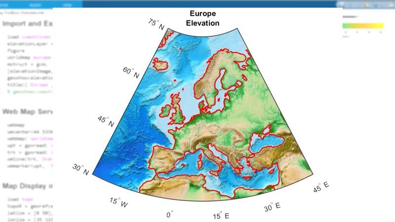
Terrain and Elevation Analysis
Visualize and Analyze 3D data such as digital terrain, bathymetry, and other gridded-data products. Calculate gradient, slope, aspect, line-of-sight visibility, and viewsheds.

Geospatial Data Processing
Perform geodetic calculations that account for the curvature of Earth and other planetary bodies.
Product Resources:
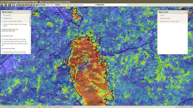
“Soon after ForWarn moved into production, it detected previously unnoticed hail damage that posed a threat to a watershed. We would not have been able to do this work as efficiently without MATLAB.”
Duane Armstrong, NASA Stennis Space Center
Get a Free Trial
30 days of exploration at your fingertips.
Ready to Buy?
Get pricing information and explore related products.
Are You a Student?
Your school may already provide access to MATLAB, Simulink, and add-on products through a campus-wide license.
What's Next?
Panel Navigation

Image Processing Toolbox
Perform image processing, visualization, and analysis
Panel Navigation

Technical Article
5 Types of Data and How to Analyze them with MATLAB
Panel Navigation

Solutions
3D Image Processing with MATLAB
You can also select a web site from the following list
Americas
- América Latina (Español)
- Canada (English)
- United States (English)
Europe
- Belgium (English)
- Denmark (English)
- Deutschland (Deutsch)
- España (Español)
- Finland (English)
- France (Français)
- Ireland (English)
- Italia (Italiano)
- Luxembourg (English)
- Netherlands (English)
- Norway (English)
- Österreich (Deutsch)
- Portugal (English)
- Sweden (English)
- Switzerland
- United Kingdom (English)
Asia Pacific
- Australia (English)
- India (English)
- New Zealand (English)
- 中国
- 日本Japanese (日本語)
- 한국Korean (한국어)