Or: Antarctic Mapping Tools for Matlab, Greenland Edition
tools. For example, The Arctic function plotpsn is equivalent to the Antarctic plotps function.PluginsHere are some Greenland datasets that are designed to work with Arctic Mapping Tools:BedMachine
- 1.9K (All time)
- 10 (Last 30 days)
- 5.0 / 5
- Community
-
5 Jan 2022

- 138 (All time)
- 1 (Last 30 days)
- -- / 5
- Community
-
14 Aug 2023
Some tools for working with data from Morlighem et al.'s BedMachine data for Greenland and Antarctica
Here are some for loading and interpolating data from BedMachine. You'll have to get the BedMachine data from the NSIDC website (https://nsidc.org/data/idbmg4 for Greenland or
- 802 (All time)
- 5 (Last 30 days)
- 5.0 / 5
- Community
-
23 Jan 2026

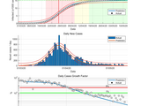
Simulation of an epidemic by classical deterministic models: SI, SIS, SIR, SIRS, SEIR, SEIRS
- 1.1K (All time)
- 1 (Last 30 days)
- -- / 5
- Community
-
8 May 2020

Estimation of coronavirus COVID-19 epidemic evaluation by the summation of logistic models
- 421 (All time)
- 1 (Last 30 days)
- 5.0 / 5
- Community
-
13 Jul 2020
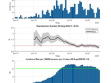
MATLAB translation of R function estimate_R for estimates the reproduction number of an epidemic from the package EpiEstim.
- 365 (All time)
- 1 (Last 30 days)
- 5.0 / 5
- Community
-
12 Aug 2020
- 5.6K (All time)
- 1 (Last 30 days)
- 4.9 / 5
- Community
-
12 May 2020

GNSS2TWS_Slepian: A software to recover daily GNSS-inverted terrestrial water storage changes based on Slepian basis functions
). Mapping Greenland's mass loss in space and time. Proc Natl Acad Sci U S A, 109, 19934-19937. doi: 10.1073/pnas.1206785109Simons, F.J., Dahlen, F.A., & Wieczorek, M.A. (2006). Spatiospectral
- 17 (All time)
- 1 (Last 30 days)
- -- / 5
- Community
-
20 Oct 2024
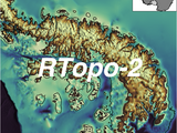
Antarctic bathymetry, ice thickness, and ice surface datasets
This is an Antarctic Mapping Tools plugin for the RTopo-2 dataset. More info on RTopo-2 can be found here: Schaffer, Janin; Timmermann, Ralph (2016): Greenland and Antarctic ice sheet topography
- 300 (All time)
- 1 (Last 30 days)
- 5.0 / 5
- Community
-
20 May 2019

Get a logical land mass corresponding to your data.
' 'Africa and Eurasia' 'North and South America' 'Greenland' 'Australia' 'Baffin Island' 'Ellesmere Island' 'New Guinea' 'Great Britain' 'Borneo' 'Honshu' 'Victoria Island
- 4.7K (All time)
- 10 (Last 30 days)
- 4.8 / 5
- Community
-
5 Dec 2014
A function to get tide data from the Polpred API
{'Aasiaat, Greenland'} 68.71 -52.883 {'Abashiri' } 44.017 144.28 {'Aberdeen' } 57.143 -2.0767 {'Aberystwyth' } 52.4 -4.0833
- 2 (All time)
- 2 (Last 30 days)
- -- / 5
- Community
-
25 Oct 2024
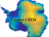
Interpolate or load raw CryoSat-2 DEM data from Helm et al. 2014 or Slater et al. 2018
, Heinz (2014): Elevation and elevation change of Greenland and Antarctica derived from CryoSat-2. The Cryosphere, 8(4), 1539-1559, http://dx.doi.org/10.5194/tc-8-1539-2014.Greene, C. A., Gwyther, D. E
- 389 (All time)
- 1 (Last 30 days)
- -- / 5
- Community
-
13 Jun 2019

COVID-19 Predictions in Africa using the SIR-Model
Use this code to predict the spread of COVID-19 in Africa or any countries of your choosing
- 359 (All time)
- 2 (Last 30 days)
- -- / 5
- Community
-
31 May 2020