Unsupervised Floodwater Depth Estimation

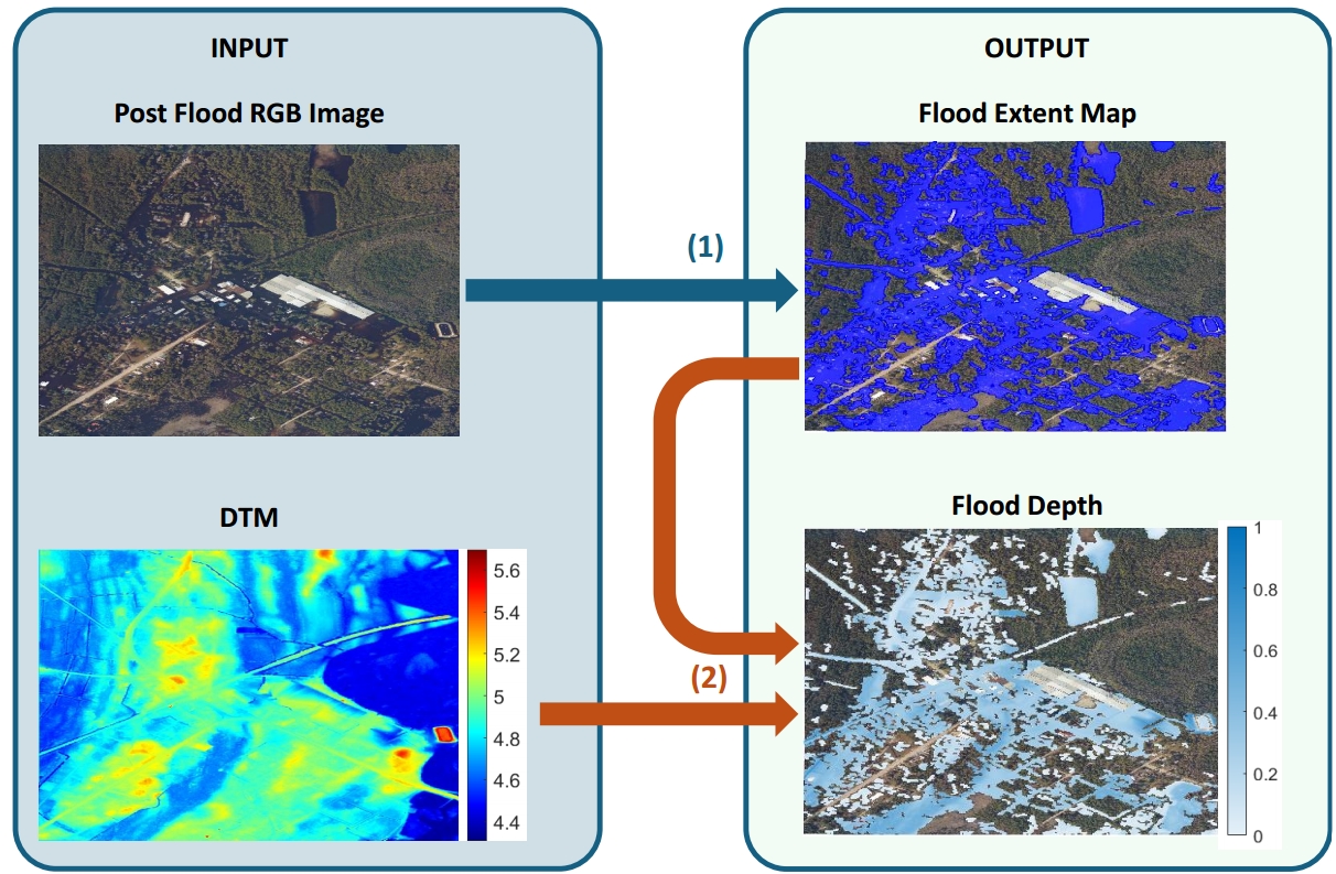
Estimates standing urban floodwater depth by coupling post-event aerial imagery with DTMs

https://sites.google.com/site/costaspanagiotakis/research/flood-detection

You are now following this Submission

We introduce a fully unsupervised framework that accurately estimates standing urban floodwater depth by coupling post-event aerial imagery with DTMs, completely eliminating the need for labeled training data. Extensive validation across twelve heterogeneous catchments demonstrated robust regional spatial generalization.
This code is a simple (not speed optimized) implementation of Floodwater Depth Estimation method proposed in [1].
Files:
getUFloodDet_Depth.m: function that implements Flood Detection method [1,2]
calculate_floodwater_depth.m: function that implements Floodwater Depth Estimation method [1]
runFloodwaterDepthEstimation.m: script of implemetation of the Floodwater Depth Estimation method [1]
You can find more details in
https://sites.google.com/site/costaspanagiotakis/research/flood-detection
We will appreciate if you cite our papers in your work:
[1] G. Simantiris, K. Bacharidis, and C. Panagiotakis, Unsupervised Estimation of Post-Event Standing Urban Floodwater Depth Using Aerial Imagery and Digital Terrain Models, Remote Sensing, 18(16), 2673, 2026.
[2] G. Simantiris and C. Panagiotakis, Unsupervised Color Based Flood Segmentation in UAV imagery, Remote Sensing, 16 (12), 2126, 2024.

Cite As

G. Simantiris, K. Bacharidis, and C. Panagiotakis, Unsupervised Estimation of Post-Event Standing Urban Floodwater Depth Using Aerial Imagery and Digital Terrain Models, Remote Sensing, 18(16), 2673, 2026.

General Information

MATLAB Release Compatibility

  • Compatible with any release

Platform Compatibility

  • Windows
  • macOS
  • Linux
Version Published Release Notes Action
1.0.3

MATLAB Release Compatibility

1.0.2

dataset update

1.0.1

Description update

1.0.0