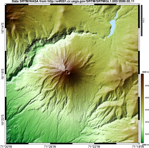
READHGT: Import/download NASA SRTM data files (.HGT)
Imports or download SRTM worldwide digital elevation model data files.

You are now following this Submission
- You will see updates in your followed content feed
- You may receive emails, depending on your communication preferences
Cite As
François Beauducel (2026). READHGT: Import/download NASA SRTM data files (.HGT) (https://www.mathworks.com/matlabcentral/fileexchange/36379-readhgt-import-download-nasa-srtm-data-files-hgt), MATLAB Central File Exchange. Retrieved .
General Information
- Version 3.0.1 (68.5 KB)
MATLAB Release Compatibility
- Compatible with any release
Platform Compatibility
- Windows
- macOS
- Linux
| Version | Published | Release Notes | Action |
|---|---|---|---|
| 3.0.1 | 3.0.1.0 with codes included (!) |
||
| 3.0.1-0 | change USGS web site to mirror for SRTM3 tiles |
||
| 3.0.0 | new option 'login' to specify user and password at NASA/EarthDATA center (free registration needed) in order to download SRTM1 tiles (in addition to 'srtm1' option). |
||
| 2.9.0 | - replaces unzip with webread function, a workaround to automatic download failure |
||
| 2.8.0 | - 'decim' option applies also to output grid(s). |
||
| 2.7.0 | adds new option 'wget' to workaround an issue with older releases (< 2014b), when downloading tiles automatically. This option works only for Linux and MacOSX. See documentation for further explanation. |
||
| 2.6.0 | MAJOR UPDATE: changed URL protocol to access USGS SRTM3 files. This is to avoid "offshore tiles" message when downloading new files. An alternative is to always use the URL option:
|
||
| 2.5.0 | updates URL for world-wide SRTM1 tiles. Still unofficial... |
||
| 2.4.0 | - fix issue when merging SRTM1 tiles |
||
| 2.3.0 | - fix a problem when SRTM1 tiles are not found. |
||
| 2.2.0 | - fix in AREA syntax |
||
| 2.1.0 | - new options 'outdir' and 'url' (replacing former syntax)
|
||
| 2.0.0 | - new syntax readhgt(AREA)
|
||
| 1.13.0 | - 'merge' option is now default. Use new 'tiles' option to plot/download individual tiles when lat/lon are vectors
|
||
| 1.12.0 | improve backward compatibility (strjoin) |
||
| 1.11.0 | corrects an issue with tiles above latitude 54N (thanks to Greg). |
||
| 1.10.0 | - bug correction in case of READHGT(FILENAME)
|
||
| 1.9.0 | - new 'interp' option that fills the novalue gaps
|
||
| 1.8.0 | minor update |
||
| 1.7.0 | - improves coding
|
||
| 1.6.0 | Bug correction when "dem.m" function is not detected. |
||
| 1.5.0 | - minor modifications
|
||
| 1.3.0 | - adds possibility to download multiple tiles with merge option
|
||
| 1.2.0 | - adjust aspect ratio with latitude
|
||
| 1.1.0 | - now reads also SRTM1 USA territory (1 arc-second resolution) data files.
|
||
| 1.0.0 |

